Brandywine Creek || Christina River || Naamans Creek || Red Clay Creek || Shellpot Creek || White Clay Creek
Christina River
Background The Christina River watershed is one of four major watersheds in the Christina Basin. The Christina Basin is part of the Delaware River Basin. The White Clay, Red Clay, and Brandywine creeks are tributaries of the Christina River and flow southward from Pennsylvania and into Delaware near Newark, Yorklyn, and Wilmington, respectively. The headwaters of the Christina River lie within the state of Maryland and enter Delaware west of Newark. The Christina River is tidal from just south of the town of Christiana to its confluence with the Delaware River at Wilmington. Lower portions of the Christina River are under tidal influence.
The Christina River is the most urbanized watershed in the Christina Basin with a majority of urban/suburban land followed by forest/wetland and agriculture uses. Collectively the White Clay, Red Clay, and Brandywine creeks and Christina River are used to supply drinking water to more than 50% of New Castle County's population. The water is distributed to residential, commercial, and industrial customers within a service area that stretches from the Pennsylvania state line in northeast New Castle County to the northern edge of the Chesapeake and Delaware Canal. Municipalities in the Christina River watershed include Newark (DE), Elkton (MD), London Britain Township (PA), and Franklin Township (PA). The watershed is the site of the Port of Wilmington, an important shipping link, and one of the largest importers of orange juice, Chilean grapes, bananas, and automobiles nationally. DNREC's Wetland Monitoring and Assessment Program (WMAP) has been developing scientifically robust methods to monitor and evaluate wetlands in Delaware on a watershed basis. Learn more about the health of the wetlands in this watershed from the DNREC Wetlands Monitoring and Assessment Program.
Water Quality The nutrient and bacteria TMDLs for the Delaware portion of the Christina River requires varied reductions based on the stream segment of between 0-62% reduction in nitrogen, between 0-77% reduction in phosphorus and between 29-95% reduction in bacteria. This watershed has sites sampled for a consistent suite of environmental contaminants. These contaminants are broadly classified as Volatile Organic Compounds (VOCs), Semi-Volatile Organic Compounds (SVOCs), Pesticides, Polychlorinated Biphenyls (PCBs) and Metals as listed using USEPA and DNREC defined standards. When sites are adjacent to water bodies sediment samples are collected to assess potential impact from a site on the health of the waters. Learn more information specific to this watershed from the DNREC Advanced Facility Search Tool.
Plants and Wildlife The tidal waters of the Christina River support a striped bass fishery and spawning grounds. Delaware's Department of Natural Resources and Environmental Control (DNREC), Division of Fish and Wildlife conducts on-going inventories of natural communities as well as rare and declining species, (e.g., state and globally-rare plants, birds, insects, mussels, reptiles, and amphibians). It maintains a database, both electronic and manual, of its findings throughout the state. Learn more about the wildlife and plant communities in this watershed from the DNREC Division of Fish and Wildlife Conservation Programs. In addition, the Division of Fish and Wildlife, working with the University of Delaware's Institute for Public Administration - Water Resources Center, maintains online databases about plants and plant communities in Delaware. Learn more about the plant communities in this watershed from the DNREC Division of Fish and Wildlife.
Recreation and Culture An urban renaissance along the Christina is underway resulting in the Riverfront Arts Center, Tubman-Garrett An urban renaissance along the Christina is underway resulting in the Riverfront Arts Center, Tubman-Garrett Riverfront Park, Christina Riverwalk, factory store outlets, restaurants, the Wilmington Blue Rocks minor league baseball stadium, urban wetland restoration and the DuPont Environmental Education Center's wildlife refuge.
Further Resources For more detailed information on this watershed, its water quality and resources, check out the following resources: Delaware TMDLs Delaware Watershed Plans Delaware Whole Basin Reports Christina Conservancy 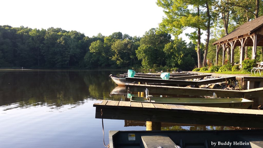 View of Sunset Lake in Newark Photo credit: Buddy Hellein | Quick facts ▲ Square Miles (total): 77.8 Square Miles (DE): 67.2 Population (total)*: 186,557 Population (DE)*: 179,370 States: DE, PA, MD Counties: DE: New Castle MD: Cecil PA: Chester *Source: U.S. Census Bureau, American Community Survey 5-year estimates, 2019.
Land cover (total)† ▲
Land cover within Delaware† ▲ †Source: National Oceanic and Atmospheric Administration, Office for Coastal Management. 2016 C-CAP Regional Land Cover. Coastal Change Analysis Program (C-CAP) Regional Land Cover.. |