Deep Creek
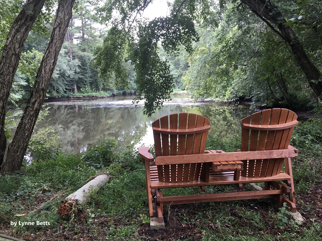
View from Old Furance Island with chairs overlooking the water
Photo credit: Lynne Betts
Photo credit: Lynne Betts
Other watersheds in the Chesapeake Bay Basin
Square Miles: 63.4
Population*: 11,145
States: DE
Counties: DE: Sussex
Land use† in Deep Creek
Bohemia Creek • Broad Creek • C & D Canal West • Chester River • Choptank River • Elk Creek • Gravelly Branch • Gum Branch • Marshyhope Creek • Nanticoke River • Perch Creek • Pocomoke River • Sassafras River • Wicomico
Background
The Deep Creek watershed is part of the Nanticoke River Drainage Basin.
Water Quality
Nutrients (nitrogen and phosphorus) and bacteria are issues within the Deep Creek Watershed.
The nonpoint source nitrogen load from the DNREC TMDL of the Deep Creek Watershed are to be reduced by 30% and the phosphorus loads are to be reduced by 50%. Also, the nonpoint source bacteria load from the DNREC TMDL of the Deep Creek watershed are to be reduced by 3%.
EPA established a Total Maximum Daily Load for nitrogen, phosphorus, and sediment for the entire Chesapeake Bay Watershed. This TMDL requires reductions of approximately 24% for nitrogen and 20% for phosphorus between 2009 and 2025 from all of the Chesapeake watersheds within Delaware. Sediment loads from Delaware’s portion of the Chesapeake must remain at 2009 levels under this TMDL.
This watershed has sites sampled for a consistent suite of environmental contaminants. These contaminants are broadly classified as Volatile Organic Compounds (VOCs), Semi-Volatile Organic Compounds (SVOCs), Pesticides, Polychlorinated Biphenyls (PCBs) and Metals as listed using USEPA and DNREC defined standards. When sites are adjacent to water bodies sediment samples are collected to assess potential impact from a site on the health of the waters. Learn more information specific to this watershed from the DNREC Advanced Facility Search Tool.
Plants and Wildlife
Deep Creek Watershed supports extensive submerged aquatic vegetation beds that are used for fish spawning, cover, and nursery areas for fish like sunfish. Siltation caused by shoreline development and destruction of shoreline buffers is a major destructive factor, killing submerged aquatic vegetation beds and smothering egg masses that are within the beds. This type of alteration would severely affect shellfish, plant, and fish species by direct take, and by alteration of spawning, nursery, and feeding habitat.
Delaware’s Department of Natural Resources and Environmental Control (DNREC), Division of Fish and Wildlife conducts on-going inventories of natural communities as well as rare and declining species, (e.g., state and globally-rare plants, birds, insects, mussels, reptiles, and amphibians). It maintains a database, both electronic and manual, of its findings throughout the state. Learn more about the wildlife and plant communities in this watershed from the DNREC Division of Fish and Wildlife Conservation Programs.
In addition, the Division of Fish and Wildlife, working with the University of Delaware’s Institute for Public Administration – Water Resources Center, maintains online databases about plants and plant communities in Delaware. Learn more about the plant communities in this watershed from the DNREC Division of Fish and Wildlife.
Further Resources
For more detailed information on this watershed, its water quality and resources, check out the following resources:
Delaware TMDLs
Chesapeake Watershed Implementation Plan
Delaware Watershed Plans
Delaware Whole Basin Reports
Delaware TMDLs
Chesapeake Watershed Implementation Plan
Delaware Watershed Plans
Delaware Whole Basin Reports
Deep Creek
Deep Creek quick stats
Square Miles: 63.4
Population*: 11,145
States: DE
Counties: DE: Sussex
*US Census Bureau, American Community Survey, 5-year estimates, 2019
Land use† in Deep Creek
†Land use source: U.S. Geological Survey (USGS), 2024, Annual NLCD Collection 1 Science Products (ver. 1.1, June 2025): U.S. Geological Survey data release, https://doi.org/10.5066/P94UXNTS.