Bohemia Creek || Broad Creek || C & D Canal West || Chester River || Choptank River || Deep Creek || Elk Creek || Gravelly Branch || Gum Branch || Marshyhope Creek || Nanticoke River || Perch Creek || Pocomoke River || Sassafras River || Wicomico
Nanticoke River
Background The Nanticoke River begins its journey in southern Delaware, flowing southwest to the Chesapeake Bay through the Lower Eastern Shore of Maryland. The Nanticoke watershed has focused development in a few small towns, including Seaford, Delaware. DNREC's Wetland Monitoring and Assessment Program (WMAP) has been developing scientifically robust methods to monitor and evaluate wetlands in Delaware on a watershed basis. Learn more about the health of the wetlands in this watershed from the DNREC Wetlands Monitoring and Assessment Program.
Water Quality There are DNREC nutrient and bacteria TMDLs for the Nanticoke watershed requiring nonpoint source reductions of 30% of nitrogen loads, 50% of phosphorus loads, and 3% of bacteria loads.
EPA established a Total Maximum Daily Load for nitrogen, phosphorus, and sediment for the entire Chesapeake Bay Watershed. This TMDL requires reductions of approximately 24% for nitrogen and 20% for phosphorus between 2009 and 2025 from all of the Chesapeake watersheds within Delaware. Sediment loads from Delaware's portion of the Chesapeake must remain at 2009 levels under this TMDL. The designated uses for the Nanticoke include primary recreation, secondary recreation, fish, aquatic life and wildlife, industrial water supply, and agricultural water supply. The waters of the Nanticoke are also designated as Waters of Exceptional Recreational and Ecological Signficance. This watershed has sites sampled for a consistent suite of environmental contaminants. These contaminants are broadly classified as Volatile Organic Compounds (VOCs), Semi-Volatile Organic Compounds (SVOCs), Pesticides, Polychlorinated Biphenyls (PCBs) and Metals as listed using USEPA and DNREC defined standards. When sites are adjacent to water bodies sediment samples are collected to assess potential impact from a site on the health of the waters. Learn more information specific to this watershed from the DNREC Advanced Facility Search Tool.
Plants and Wildlife The Nanticoke is the most biologically diverse watershed on Delmarva. It is free of dams and supports excellent fisheries. It also has the highest concentration of bald eagles in the northeastern United States. The Nanticoke Watershed is also home to naturally occuring bald cypress trees. Delaware's Department of Natural Resources and Environmental Control (DNREC), Division of Fish and Wildlife conducts on-going inventories of natural communities as well as rare and declining species, (e.g., state and globally-rare plants, birds, insects, mussels, reptiles, and amphibians). It maintains a database, both electronic and manual, of its findings throughout the state. Learn more about the wildlife and plant communities in this watershed from the DNREC Division of Fish and Wildlife Conservation Programs. In addition, the Division of Fish and Wildlife, working with the University of Delaware's Institute for Public Administration - Water Resources Center, maintains online databases about plants and plant communities in Delaware. Learn more about the plant communities in this watershed from the DNREC Division of Fish and Wildlife.
Recreation and Culture The same bounteous environment that supported the Nanticoke native american tribe supports most recreation, such as fishing and hunting, today. Many people also enjoy bicycling, canoeing, and hiking in the area to enjoy the lovely surroundings. The Nanticoke region has a rich history including sites, structures, and various other evidence of human occupancy or activity. There is an abundance of evidence for both Native American and European-American settlements containing many interesting artifacts. Captain John Smith set off on the Chesapeake Bay around 6 June 1608, determined to discover the mythical treasures of the Far East. While on his adventure, he came upon the river we now call the Nanticoke. He became acquainted with the Native Americans residing near the River, calling them the Nantaquak. Unable to successfully farm on the marshy ground, they thrived predominately on hunting and fishing. The Nanticoke were accomplished canoeists, and their close ties to the River inspired their name, which means 'those who ply the tidal stream,' 'sea shore settlers,' or 'tidewater people.' Evidence of Native American habitation can be found along the river systems in the Nanticoke watershed. The Nanticoke tribe established a network of villages and encampments, which persisted until the area was taken over by European settlers. Artifacts include piles of discarded oyster shell called shell middens. There are additional deposits that contain stone tools and property. Over 300 archeological sites have been documented in the Nanticoke River.
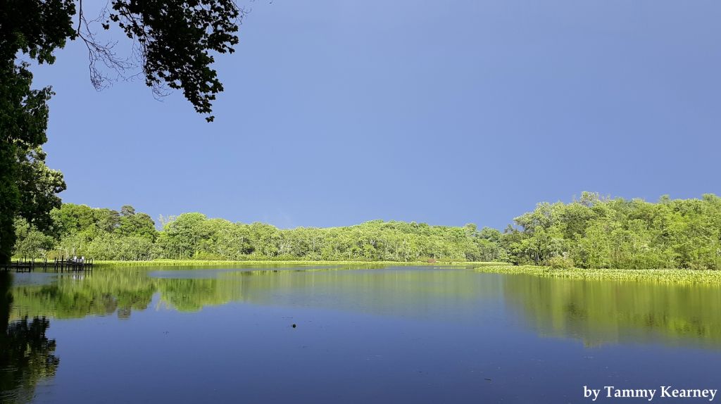
Further Resources For more detailed information on this watershed, its water quality and resources, check out the following resources: Delaware TMDLs Chesapeake Watershed Implementation Plan Delaware Watershed Plans Delaware Whole Basin Reports Nanticoke Watershed Alliance  View of Nanticoke River in Seaford Photo credit: Tammy Kearney | Quick facts ▲ Square Miles (total): 349.2 Square Miles (DE): 144.2 Population (total)*: 46,215 Population (DE)*: 33,100 States: DE, MD Counties: DE: Sussex MD: Wicomico and Dorchester *Source: U.S. Census Bureau, American Community Survey 5-year estimates, 2019.
Land cover (total)† ▲
Land cover within Delaware† ▲ †Source: National Oceanic and Atmospheric Administration, Office for Coastal Management. 2016 C-CAP Regional Land Cover. Coastal Change Analysis Program (C-CAP) Regional Land Cover.. |