Marshyhope Creek
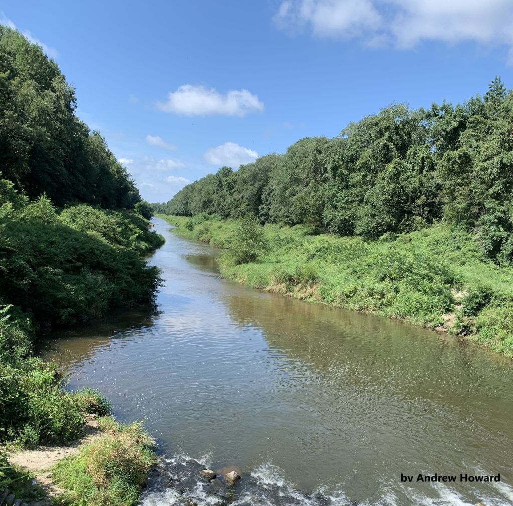
View of Marshyhope Creek and its shores
Photo credit: Andrew Howard
Photo credit: Andrew Howard
Other watersheds in the Chesapeake Bay Basin
Square Miles (total): 220.4
Square Miles (DE): 96.3
Population (total)*: 17,669
Population (DE)*: 7,954
States: DE, MD
Counties: DE: Kent and Sussex MD: Caroline and Dorchester
Land use† in Marshyhope Creek
Bohemia Creek • Broad Creek • C & D Canal West • Chester River • Choptank River • Deep Creek • Elk Creek • Gravelly Branch • Gum Branch • Nanticoke River • Perch Creek • Pocomoke River • Sassafras River • Wicomico
Background
Marshyhope Creek watershed is located on the western edge of Delaware and resides in both Kent and Sussex counties. The stream flows southwestward and crosses the state line into Maryland where it eventually discharges into the Chesapeake Bay.
The land use within the watershed is dominated by agriculture, wetlands, and forests. Farmington is the only incorporated town.
The land use within the watershed is dominated by agriculture, wetlands, and forests. Farmington is the only incorporated town.
Water Quality
The DNREC TMDLs for the Marshyhope Creek require a 21% reduction in bacteria, a 20% reduction in nitrogen, and a 25% reduction in phosphorus.
EPA established a Total Maximum Daily Load for nitrogen, phosphorus, and sediment for the entire Chesapeake Bay Watershed. This TMDL requires reductions of approximately 24% for nitrogen and 20% for phosphorus between 2009 and 2025 from all of the Chesapeake watersheds within Delaware. Sediment loads from Delaware’s portion of the Chesapeake must remain at 2009 levels under this TMDL.
The waters of the Marshyhope Creek Watershed are designated for primary contact recreation, secondary contact recreation, fish, aquatic life and wildlife, agricultural supply, and industrial supply. Marshyhope is also designated as a water of Exceptional Recreation or Ecological Significance (ERES).
This watershed has sites sampled for a consistent suite of environmental contaminants. These contaminants are broadly classified as Volatile Organic Compounds (VOCs), Semi-Volatile Organic Compounds (SVOCs), Pesticides, Polychlorinated Biphenyls (PCBs) and Metals as listed using USEPA and DNREC defined standards. When sites are adjacent to water bodies sediment samples are collected to assess potential impact from a site on the health of the waters. Learn more information specific to this watershed from the DNREC Advanced Facility Search Tool.
Plants and Wildlife
Delaware’s Department of Natural Resources and Environmental Control (DNREC), Division of Fish and Wildlife conducts on-going inventories of natural communities as well as rare and declining species, (e.g., state and globally-rare plants, birds, insects, mussels, reptiles, and amphibians). It maintains a database, both electronic and manual, of its findings throughout the state. Learn more about the wildlife and plant communities in this watershed from the DNREC Division of Fish and Wildlife Conservation Programs.
In addition, the Division of Fish and Wildlife, working with the University of Delaware’s Institute for Public Administration – Water Resources Center, maintains online databases about plants and plant communities in Delaware. Learn more about the plant communities in this watershed from the DNREC Division of Fish and Wildlife.
In addition, the Division of Fish and Wildlife, working with the University of Delaware’s Institute for Public Administration – Water Resources Center, maintains online databases about plants and plant communities in Delaware. Learn more about the plant communities in this watershed from the DNREC Division of Fish and Wildlife.
Further Resources
For more detailed information on this watershed, its water quality and resources, check out the following resources:
Delaware TMDLs
Chesapeake Watershed Implementation Plan
Delaware Watershed Plans
Delaware Whole Basin Reports
Delaware TMDLs
Chesapeake Watershed Implementation Plan
Delaware Watershed Plans
Delaware Whole Basin Reports
Marshyhope Creek
Marshyhope Creek quick stats
Square Miles (total): 220.4
Square Miles (DE): 96.3
Population (total)*: 17,669
Population (DE)*: 7,954
States: DE, MD
Counties: DE: Kent and Sussex MD: Caroline and Dorchester
*US Census Bureau, American Community Survey, 5-year estimates, 2019
Land use† in Marshyhope Creek
†Land use source: U.S. Geological Survey (USGS), 2024, Annual NLCD Collection 1 Science Products (ver. 1.1, June 2025): U.S. Geological Survey data release, https://doi.org/10.5066/P94UXNTS.