Brandywine Creek || Christina River || Naamans Creek || Red Clay Creek || Shellpot Creek || White Clay Creek
Brandywine Creek
Background The Brandywine Creek watershed is one of four major watersheds in the Christina Basin. The Christina Basin is part of the Delaware River Basin. The Brandywine Creek is a tributary of the Christina River and flows southward out of Pennsylvania and into Delaware near Wilmington. The creek flows through Wilmington and enters the Christina River just before the Delaware River. The majority of the watershed is located in Chester County (PA). Lower portions of the Brandywine Creek are under tidal influence. Major land use areas in the Brandywine include agriculture followed by forest/wetland, and urban uses. Collectively the White Clay, Red Clay, and Brandywine creeks and Christina River are used to supply drinking water to more than 50% of New Castle County's population. The Brandywine Creek has six surface water intakes and numerous public water supply wells located within the watershed for public water supplies. The Brandywine Creek serves as a major source of drinking water supplies with four reservoirs (Chambers Lake, Marsh Creek, Rock Run, and Hoopes) supplying water to central Chester and northern New Castle Counties. All together there are 48 municipalities in the two states that are either fully or partially within the watershed. DNREC's Wetland Monitoring and Assessment Program (WMAP) has been developing scientifically robust methods to monitor and evaluate wetlands in Delaware on a watershed basis. Learn more about the health of the wetlands in this watershed from the DNREC Wetlands Monitoring and Assessment Program.
Water Quality The nutrient and bacteria TMDLs for the Delaware portion of the Brandywine requires varied reductions based on the stream segment of between 0-62% reduction in nitrogen, between 0-77% reduction in phosphorus and between 29-95% reduction in bacteria. This watershed has sites sampled for a consistent suite of environmental contaminants. These contaminants are broadly classified as Volatile Organic Compounds (VOCs), Semi-Volatile Organic Compounds (SVOCs), Pesticides, Polychlorinated Biphenyls (PCBs) and Metals as listed using USEPA and DNREC defined standards. When sites are adjacent to water bodies sediment samples are collected to assess potential impact from a site on the health of the waters. Learn more information specific to this watershed from the DNREC Advanced Facility Search Tool.
Plants and Wildlife The Brandywine Creek provides the only sustainable smallmouth bass fishery in the state of Delaware. Beaver Creek (PA) is designated as naturally reproducing trout waters. Delaware's Department of Natural Resources and Environmental Control (DNREC), Division of Fish and Wildlife conducts on-going inventories of natural communities as well as rare and declining species, (e.g., state and globally-rare plants, birds, insects, mussels, reptiles, and amphibians). It maintains a database, both electronic and manual, of its findings throughout the state. Learn more about the wildlife and plant communities in this watershed from the DNREC Division of Fish and Wildlife Conservation Programs. In addition, the Division of Fish and Wildlife, working with the University of Delaware's Institute for Public Administration - Water Resources Center, maintains online databases about plants and plant communities in Delaware. Learn more about the plant communities in this watershed from the DNREC Division of Fish and Wildlife.
Recreation and Culture Brandywine Creek is designated as a PA Scenic River from the PA-DE state line upstream to Mortonville Dam (West Branch Brandywine Creek) and to Downingtown (East Branch Brandywine Creek). The headwaters of the watershed are designated as High Quality Waters, and Broad Run is designated as an Exceptional Value watershed. Hundreds of historic sites dot the watershed. Evidence of the economic development of the 18th and 19th centuries can be seen as numerous mills were built to utilize the extensive water power found in high gradient streams of the watershed. The watershed is also filled with covered bridges, historic structures, districts, landmarks, and bridges.
Further Resources For more detailed information on this watershed, its water quality and resources, check out the following resources: Delaware TMDLs Chester County Water Resources Plans Delaware Watershed Plans Delaware Whole Basin Reports Brandywine Red Clay Alliance 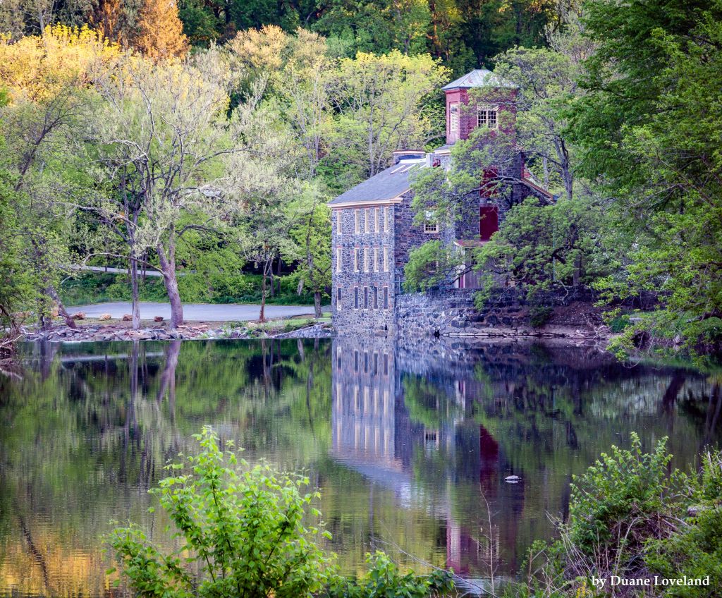 View of Breck's Mill on the Brandywine Creek Photo credit: Duane Loveland | Quick facts ▲ Square Miles (total): 324.2 Square Miles (DE): 23.0 Population (total)*: 266,582 Population (DE)*: 47,254 States: DE, PA Counties: DE: New Castle PA: Chester, Delaware, Lancaster *Source: U.S. Census Bureau, American Community Survey 5-year estimates, 2019.
Land cover (total)† ▲
Land cover within Delaware† ▲ †Source: National Oceanic and Atmospheric Administration, Office for Coastal Management. 2016 C-CAP Regional Land Cover. Coastal Change Analysis Program (C-CAP) Regional Land Cover.. |