Choptank River
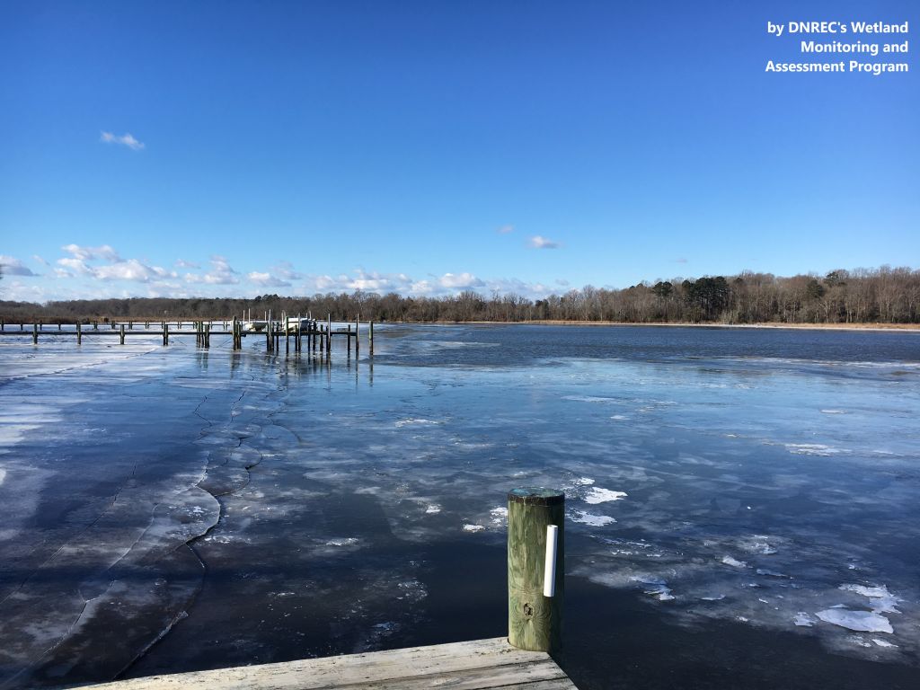
View of the Choptank River in winter
Photo credit: DNREC’s Wetland Monitoring and Assessment Program
Photo credit: DNREC’s Wetland Monitoring and Assessment Program
Other watersheds in the Chesapeake Bay Basin
Square Miles (total): 255.2
Square Miles (DE): 97.1
Population (total)*: 29,395
Population (DE)*: 10,365
States: DE, MD
Counties: DE: Kent MD: Caroline
Land use† in Choptank River
Bohemia Creek • Broad Creek • C & D Canal West • Chester River • Deep Creek • Elk Creek • Gravelly Branch • Gum Branch • Marshyhope Creek • Nanticoke River • Perch Creek • Pocomoke River • Sassafras River • Wicomico
Background
The Choptank River watershed is located on the western edge of Delaware and resides in Kent County. The Choptank River watershed consists of Tappahanna Ditch in the northern portion of the watershed, Culbreth Marsh Ditch in the center, and Cow Marsh Creek in the lower portion. Both Tappahanna Ditch and Culbreth Marsh Ditch drain to Mud Millpond, which is situated at the Maryland-Delaware state line. The pond discharges to the Choptank River in Delaware, which meanders southward, where Cow Marsh Creek connects in before continuing into Maryland.
The land use in the watershed is dominated by agriculture, wetlands and forest.
DNREC’s Wetland Monitoring and Assessment Program (WMAP) has been developing scientifically robust methods to monitor and evaluate wetlands in Delaware on a watershed basis. For more information on the health of the wetlands in this watershed, click here.
Water Quality
DNREC’s nutrient TMDLs for the Choptank River Watershed include a yearly-average cap on total nitrogen and a 40% reduction in phosphorus levels. Also, the nonpoint source bacteria load in the Choptank requires a 29% reduction.
EPA established a Total Maximum Daily Load for nitrogen, phosphorus, and sediment for the entire Chesapeake Bay Watershed. This TMDL requires reductions of approximately 24% for nitrogen and 20% for phosphorus between 2009 and 2025 from all of the Chesapeake watersheds within Delaware. Sediment loads from Delaware’s portion of the Chesapeake must remain at 2009 levels under this TMDL.
The designated uses for the Choptank River Watershed include primary contact recreation, secondary contact recreation, fish, aquatic life and wildlife, agricultural water supply, and industrial water supply.
This watershed has sites sampled for a consistent suite of environmental contaminants. These contaminants are broadly classified as Volatile Organic Compounds (VOCs), Semi-Volatile Organic Compounds (SVOCs), Pesticides, Polychlorinated Biphenyls (PCBs) and Metals as listed using USEPA and DNREC defined standards. When sites are adjacent to water bodies sediment samples are collected to assess potential impact from a site on the health of the waters. Learn more information specific to this watershed from the DNREC Advanced Facility Search Tool.
Plants and Wildlife
The riparian habitats associated with the Choptank include some of the finest and most diverse habitats in Kent County and are home to many species or rare plants and rare animals.
Delaware’s Department of Natural Resources and Environmental Control (DNREC), Division of Fish and Wildlife conducts on-going inventories of natural communities as well as rare and declining species, (e.g., state and globally-rare plants, birds, insects, mussels, reptiles, and amphibians). It maintains a database, both electronic and manual, of its findings throughout the state. Learn more about the wildlife and plant communities in this watershed from the DNREC Division of Fish and Wildlife Conservation Programs.
In addition, the Division of Fish and Wildlife, working with the University of Delaware’s Institute for Public Administration – Water Resources Center, maintains online databases about plants and plant communities in Delaware. Learn more about the plant communities in this watershed from the DNREC Division of Fish and Wildlife.
Further Resources
For more detailed information on this watershed, its water quality and resources, check out the following resources:
Delaware TMDLs
Chesapeake Watershed Implementation Plan
Delaware Watershed Plans
Delaware Whole Basin Reports
Shorerivers
Delaware TMDLs
Chesapeake Watershed Implementation Plan
Delaware Watershed Plans
Delaware Whole Basin Reports
Shorerivers
Choptank River
Choptank River quick stats
Square Miles (total): 255.2
Square Miles (DE): 97.1
Population (total)*: 29,395
Population (DE)*: 10,365
States: DE, MD
Counties: DE: Kent MD: Caroline
*US Census Bureau, American Community Survey, 5-year estimates, 2019
Land use† in Choptank River
†Land use source: U.S. Geological Survey (USGS), 2024, Annual NLCD Collection 1 Science Products (ver. 1.1, June 2025): U.S. Geological Survey data release, https://doi.org/10.5066/P94UXNTS.