C & D Canal West
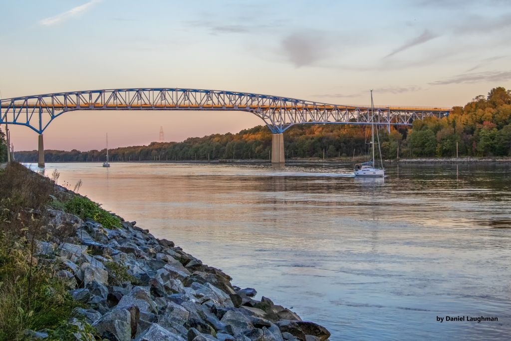
View of Summit Bridge over the C and D Canal
Photo credit: Daniel Laughman
Photo credit: Daniel Laughman
Other watersheds in the Chesapeake Bay Basin
Square Miles:
Population*:
States:
Counties:
Land use† in C & D Canal West
Bohemia Creek • Broad Creek • Chester River • Choptank River • Deep Creek • Elk Creek • Gravelly Branch • Gum Branch • Marshyhope Creek • Nanticoke River • Perch Creek • Pocomoke River • Sassafras River • Wicomico
Background
The Chesapeake and Delaware Canal West watershed (C & D Canal) contains the C & D Canal, a navigational waterway to the Port of Baltimore maintained by the U.S. Army Corps of Engineers. The canal system provides a continuous sea-level channel connecting the Port of Baltimore to the northern ports of Wilmington, Philadelphia, and northern trade routes.
The Chesapeake and Delaware Canal West watershed is one of only three tidal watersheds in the Chesapeake Basin. The C & D Canal West watershed has several notable waterways including Long Creek, Back Creek and Sammons Pond.
The land along the Canal is used for recreation, agriculture, dredge disposal and wildlife habitat. The majority of the C & D Canal West watershed is agricultural with a small amount of development.
Water Quality
EPA established a Total Maximum Daily Load for nitrogen, phosphorus, and sediment for the entire Chesapeake Bay Watershed. This TMDL requires reductions of approximately 24% for nitrogen and 20% for phosphorus between 2009 and 2025 from all of the Chesapeake watersheds within Delaware. Sediment loads from Delaware’s portion of the Chesapeake must remain at 2009 levels under this TMDL.
Plants and Wildlife
Delaware’s Department of Natural Resources and Environmental Control (DNREC), Division of Fish and Wildlife conducts on-going inventories of natural communities as well as rare and declining species, (e.g., state and globally-rare plants, birds, insects, mussels, reptiles, and amphibians). It maintains a database, both electronic and manual, of its findings throughout the state. Learn more about the wildlife and plant communities in this watershed from the DNREC Division of Fish and Wildlife Conservation Programs.
In addition, the Division of Fish and Wildlife, working with the University of Delaware’s Institute for Public Administration – Water Resources Center, maintains online databases about plants and plant communities in Delaware. Learn more about the plant communities in this watershed from the DNREC Division of Fish and Wildlife.
In addition, the Division of Fish and Wildlife, working with the University of Delaware’s Institute for Public Administration – Water Resources Center, maintains online databases about plants and plant communities in Delaware. Learn more about the plant communities in this watershed from the DNREC Division of Fish and Wildlife.
Recreation and Culture
The Chesapeake and Delaware Canal is listed on the National Register of Historic Places and is designated as a National Historic Civil Engineering and Mechanical Engineering landmark. The canal is unique as the only major commercial navigation waterway in the United States built during the early 1800s and still in use.
The U.S. Army Corps of Engineers maintains a Canal Museum in Chesapeake City, MD which provides visitors with a glimpse of the canal’s early days. The waterwheel and pumping engines remain in the original pumphouse, which is on display in the museum. These steam engines are the oldest of their type in America still on their original foundations. Other artifacts and exhibits in the museum detail and illustrate the canal’s history.
The U.S. Army Corps of Engineers maintains a Canal Museum in Chesapeake City, MD which provides visitors with a glimpse of the canal’s early days. The waterwheel and pumping engines remain in the original pumphouse, which is on display in the museum. These steam engines are the oldest of their type in America still on their original foundations. Other artifacts and exhibits in the museum detail and illustrate the canal’s history.
Further Resources
For more detailed information on this watershed, its water quality and resources, check out the following resources:
Delaware TMDLs
Chesapeake Watershed Implementation Plan
Delaware Watershed Plans
Delaware Whole Basin Reports
Delaware TMDLs
Chesapeake Watershed Implementation Plan
Delaware Watershed Plans
Delaware Whole Basin Reports
C & D Canal West
C & D Canal West quick stats
Square Miles:
Population*:
States:
Counties:
*US Census Bureau, American Community Survey, 5-year estimates, 2019
Land use† in C & D Canal West
†Land use source: U.S. Geological Survey (USGS), 2024, Annual NLCD Collection 1 Science Products (ver. 1.1, June 2025): U.S. Geological Survey data release, https://doi.org/10.5066/P94UXNTS.