Appoquinimink River || Army Creek || Blackbird Creek || Broadkill River || C & D Canal East || Cedar Creek || Delaware Bay Drainage || Delaware River Drainage || Dragon Run Creek || Leipsic River || Little Creek || Mispillion River || Murderkill River || Red Lion Creek || Smyrna River || St. Jones River
Broadkill River
Background The Broadkill River watershed is located in the east central portion of Sussex County. The mainstem of the Broadkill River is approximately 25 miles long. The major watercourse in this segment is the Broadkill River which originates at the Town of Milton and discharges into the Roosevelt Inlet near Lewes. Major waterbodies in the area are Waggamons Pond and Diamond Pond located near Milton. The Broadkill River flows generally eastward until it approaches the coast where it turns abruptly and flows south to discharge into the Roosevelt Inlet. There is only one small incorporated community, the Town of Milton, within the watershed. The primary land uses in the area are agriculture and wildlife refuge. DNREC's Wetland Monitoring and Assessment Program (WMAP) has been developing scientifically robust methods to monitor and evaluate wetlands in Delaware on a watershed basis. Learn more about the health of the wetlands in this watershed from the DNREC Wetlands Monitoring and Assessment Program.
Water Quality There are nutrient and bacteria TMDLs for the Broadkill River watershed that require point source nitrogen loads capped at 245.6 lbs/day, point source phosphorus loads capped at 28 lbs/day, bacteria point source loads capped at 1.67E+09 colony forming units (CFU) per day, nonpoint source nitrogen reductions of 40%, nonpoint phosphorus reductions of 40%, and nonpoint bacteria reductions of 75%. The designated uses for the Broadkill include primary recreation, secondary recreation, fish, aquatic life and wildlife, industrial water supply, and agricultural water supply in freshwater segments. This watershed has sites sampled for a consistent suite of environmental contaminants. These contaminants are broadly classified as Volatile Organic Compounds (VOCs), Semi-Volatile Organic Compounds (SVOCs), Pesticides, Polychlorinated Biphenyls (PCBs) and Metals as listed using USEPA and DNREC defined standards. When sites are adjacent to water bodies sediment samples are collected to assess potential impact from a site on the health of the waters. Learn more information specific to this watershed from the DNREC Advanced Facility Search Tool.
Plants and Wildlife The tidal marshes along the coast are part of a Prime Hook National Wildlife Refuge. Prime Hook National Wildlife Refuge is located on the west shore of Delaware Bay, about 22 miles southeast of Dover, and 64 miles southeast of Wilmington, Delaware. The refuge has one of the best thriving wetland habitat areas along the Atlantic Coast. These habitats have become important rest points for spring and fall migrating shorebirds and wading birds. Endangered and threatened species management activities provide habitat for the Delmarva fox squirrel, nesting bald eagles, and migrating peregrine falcons. Neotropical land birds passing through utilize the refuge's upland forested habitat during the fall and spring. Significant areas of Atlantic white cedar are also found in the Broadkill. Delaware's Department of Natural Resources and Environmental Control (DNREC), Division of Fish and Wildlife conducts on-going inventories of natural communities as well as rare and declining species, (e.g., state and globally-rare plants, birds, insects, mussels, reptiles, and amphibians). It maintains a database, both electronic and manual, of its findings throughout the state. Learn more about the wildlife and plant communities in this watershed from the DNREC Division of Fish and Wildlife Conservation Programs. In addition, the Division of Fish and Wildlife, working with the University of Delaware's Institute for Public Administration - Water Resources Center, maintains online databases about plants and plant communities in Delaware. Learn more about the plant communities in this watershed from the DNREC Division of Fish and Wildlife.
Recreation and Culture The Broadkill River Canoe Trail links the Town of Milton to the Edward H. McCabe Preserve, just three miles to the east. Canoes are available to rent at Wilson's Sunshine Marina, and paddlers can put in at Memorial Park.
Further Resources For more detailed information on this watershed, its water quality and resources, check out the following resources: Delaware TMDLs Delaware Watershed Plans Delaware Whole Basin Reports CCMP for the Delaware Estuary 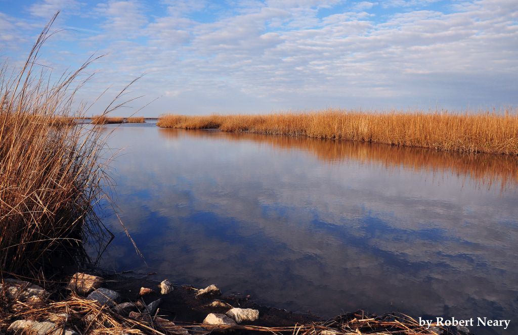 View from Prime Hook Photo credit: Robert Neary | Quick facts ▲ Square Miles: 107.1 Population*: 28,648 States: DE Counties: DE: New Castle *Source: U.S. Census Bureau, American Community Survey 5-year estimates, 2019.
Land cover (total)† ▲ †Source: National Oceanic and Atmospheric Administration, Office for Coastal Management. 2016 C-CAP Regional Land Cover. Coastal Change Analysis Program (C-CAP) Regional Land Cover.. |