Appoquinimink River || Army Creek || Blackbird Creek || Broadkill River || C & D Canal East || Cedar Creek || Delaware Bay Drainage || Delaware River Drainage || Dragon Run Creek || Leipsic River || Little Creek || Mispillion River || Murderkill River || Red Lion Creek || Smyrna River || St. Jones River
Appoquinimink River
Background The 16-mile Appoquinimink River meanders through farmlands and wetlands in southern New Castle County. The headwater drains mostly agricultural lands, and feeds four major ponds. The tidal freshwater segment of the Appoquinimink is bound by the head of tide at Noxontown Pond and Silver Lake, and by Drawyers Creek's confluence with the Appoquinimink. The remainder of the watershed consists of a tidal marsh extending to the Delaware River. There are several shallow, man-made small lakes and ponds in the watershed: Wiggins Mill Pond, Noxontown Pond, Silver Lake, and Shallcross Lake. The Appoquinimink River is tidal from the confluence with Delaware Bay to the dam at Noxontown Lake on the main stem, the dam at Silver Lake on Deep Creek, and the confluence with Drawyer Creek. The Appoquinimink watershed, which includes the towns of Odessa, Townsend and Middletown, is a fast growing area in the state with previous agricultural areas changing to suburban. A small area of the watershed remains forested, and those areas are located along the stream valley with very few large continuous tracts of un-fragmented forest remaining. DNREC's Wetland Monitoring and Assessment Program (WMAP) has been developing scientifically robust methods to monitor and evaluate wetlands in Delaware on a watershed basis. Learn more about the health of the wetlands in this watershed from the DNREC Wetlands Monitoring and Assessment Program.
Water Quality A Total Maximum Daily Load for nutrients and bacteria has been established for the Appoquinimink River requiring a 60% reduction in nitrogen and phosphorus loads and a bacteria reduction of between 11-15% in freshwater areas and 72-73% in marine areas. This watershed has sites sampled for a consistent suite of environmental contaminants. These contaminants are broadly classified as Volatile Organic Compounds (VOCs), Semi-Volatile Organic Compounds (SVOCs), Pesticides, Polychlorinated Biphenyls (PCBs) and Metals as listed using USEPA and DNREC defined standards. When sites are adjacent to water bodies sediment samples are collected to assess potential impact from a site on the health of the waters. Learn more information specific to this watershed from the DNREC Advanced Facility Search Tool.
Plants and Wildlife The Appoquinimink River is designated as a warm-water fishery. The wetlands found throughout the watershed are highly valued as habitat for waterfowl, shorebirds and other wildlife, and as spawning and nursery areas for fish and aquatic life. The Appoquinimink watershed is also home to many species including the bald eagle, bog turtle, and different species of hawks. It also supports abundant wildlife including herons, egrets, kingfishers, osprey, swallows, otters, minks, beavers, deer, flying squirrels, meadow jumping mice, bats, and opossums. Delaware's Department of Natural Resources and Environmental Control (DNREC), Division of Fish and Wildlife conducts on-going inventories of natural communities as well as rare and declining species, (e.g., state and globally-rare plants, birds, insects, mussels, reptiles, and amphibians). It maintains a database, both electronic and manual, of its findings throughout the state. Learn more about the wildlife and plant communities in this watershed from the DNREC Division of Fish and Wildlife Conservation Programs. In addition, the Division of Fish and Wildlife, working with the University of Delaware's Institute for Public Administration - Water Resources Center, maintains online databases about plants and plant communities in Delaware. Learn more about the plant communities in this watershed from the DNREC Division of Fish and Wildlife.
Recreation and Culture Through the years, residents in the watershed have enjoyed the many recreational opportunities provided by the river, including boating, swimming, bird watching and fishing.
Further Resources For more detailed information on this watershed, its water quality and resources, check out the following resources: Delaware TMDLs Delaware Watershed Plans Delaware Whole Basin Reports CCMP for the Delaware Estuary 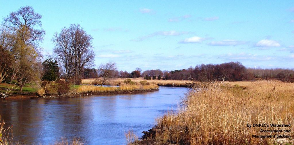 View of the Appoquinimink River and its shore Photo credit: DNREC's Watershed Assessment and Management Section | Quick facts ▲ Square Miles: 46.3 Population*: 28,875 States: DE Counties: DE: New Castle *Source: U.S. Census Bureau, American Community Survey 5-year estimates, 2019.
Land cover (total)† ▲ †Source: National Oceanic and Atmospheric Administration, Office for Coastal Management. 2016 C-CAP Regional Land Cover. Coastal Change Analysis Program (C-CAP) Regional Land Cover.. |