Appoquinimink River || Army Creek || Blackbird Creek || Broadkill River || C & D Canal East || Cedar Creek || Delaware Bay Drainage || Delaware River Drainage || Dragon Run Creek || Leipsic River || Little Creek || Mispillion River || Murderkill River || Red Lion Creek || Smyrna River || St. Jones River
C & D Canal East
Background The Chesapeake and Delaware Canal East watershed (C and D Canal East) contains the Chesapeake & Delaware Canal, a navigational waterway to the Port of Baltimore maintained by the U.S. Army Corps of Engineers. The canal system provides a continuous sea-level channel connecting the Port of Baltimore to the northern ports of Wilmington, Philadelphia, and northern trade routes. The canal carries 40 percent of all ship traffic in and out of the Port of Baltimore.
The C and D Canal East watershed has several notable waterways including Scott Run and Lums Pond. The federal government owns nearly 9,000 acres along the Chesapeake & Delaware Canal. The land along the canal is used for recreation, agriculture, dredge disposal and habitat. Man-made embankments along the canal are the result of years of disposal activity and maintenance of canal depths. Through a series of agreements, the states of Delaware and Maryland manage property along the canal for recreation and wildlife management. The majority of the C and D Canal East watershed is rural with low marshland utilized primarily as wildlife habitat. There are also the developed areas of Port Penn, part of Delaware City, and St. Georges.
Water Quality There are nutrient TMDLs for the Lums Pond subwatershed of the C and D Canal East watershed that require 40% reductions in nitrogen and phosphorus loads. There is also a Carbonaceous Biochemical Oxygen Demand (CBOD5) reduction of 40%.
This watershed has sites sampled for a consistent suite of environmental contaminants. These contaminants are broadly classified as Volatile Organic Compounds (VOCs), Semi-Volatile Organic Compounds (SVOCs), Pesticides, Polychlorinated Biphenyls (PCBs) and Metals as listed using USEPA and DNREC defined standards. When sites are adjacent to water bodies sediment samples are collected to assess potential impact from a site on the health of the waters. Learn more information specific to this watershed from the DNREC Advanced Facility Search Tool.
Plants and Wildlife Delaware's Department of Natural Resources and Environmental Control (DNREC), Division of Fish and Wildlife conducts on-going inventories of natural communities as well as rare and declining species, (e.g., state and globally-rare plants, birds, insects, mussels, reptiles, and amphibians). It maintains a database, both electronic and manual, of its findings throughout the state. Learn more about the wildlife and plant communities in this watershed from the DNREC Division of Fish and Wildlife Conservation Programs. In addition, the Division of Fish and Wildlife, working with the University of Delaware's Institute for Public Administration - Water Resources Center, maintains online databases about plants and plant communities in Delaware. Learn more about the plant communities in this watershed from the DNREC Division of Fish and Wildlife.
Recreation and Culture Lums Pond State Park is found in the C and D Canal East watershed. Lums Pond State Park is built around the largest freshwater pond in Delaware. The park features fishing, boating, sports facilities, and hiking trails. Hikers have the opportunity to explore a variety of habitats along the Swamp Forest Trail circling the pond. Lums also features miles of multi-purpose trails (horses, bikes, hikers, snowmobiles). The Whale Wallow Nature Center hosts a variety of programs for visitors during the summer season. Ball fields and game courts abound at Lums Pond State Park as well as the Summit North Marina offering private boat slips.
The Chesapeake & Delaware Canal is listed on the National Register of Historic Places and is designated as a National Historic Civil Engineering and Mechanical Engineering landmark. The canal is unique as the only major commercial navigation waterway in the United States built during the early 1800s and still in use.
Further Resources For more detailed information on this watershed, its water quality and resources, check out the following resources: Delaware TMDLs Delaware Whole Basin Reports CCMP for the Delaware Estuary 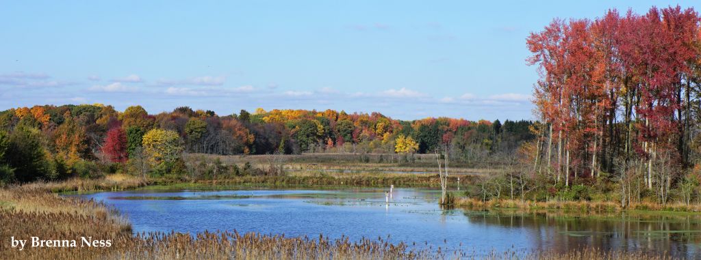 View of Augustine Creek from Delaware Wildlands Betts Farm Photo credit: Brenna Ness | Quick facts ▲ Square Miles: Population*: States: Counties: *Source: U.S. Census Bureau, American Community Survey 5-year estimates, 2019.
Land cover (total)† ▲ †Source: National Oceanic and Atmospheric Administration, Office for Coastal Management. 2016 C-CAP Regional Land Cover. Coastal Change Analysis Program (C-CAP) Regional Land Cover.. |